Argo Navigation and Social Boating app includes routing capability on all waterways in North America
Our growing community of boaters use Argo all over North America, and have the ability to plan & take boat trips from Canada, to the U.S. and all the way south into the Caribbean.
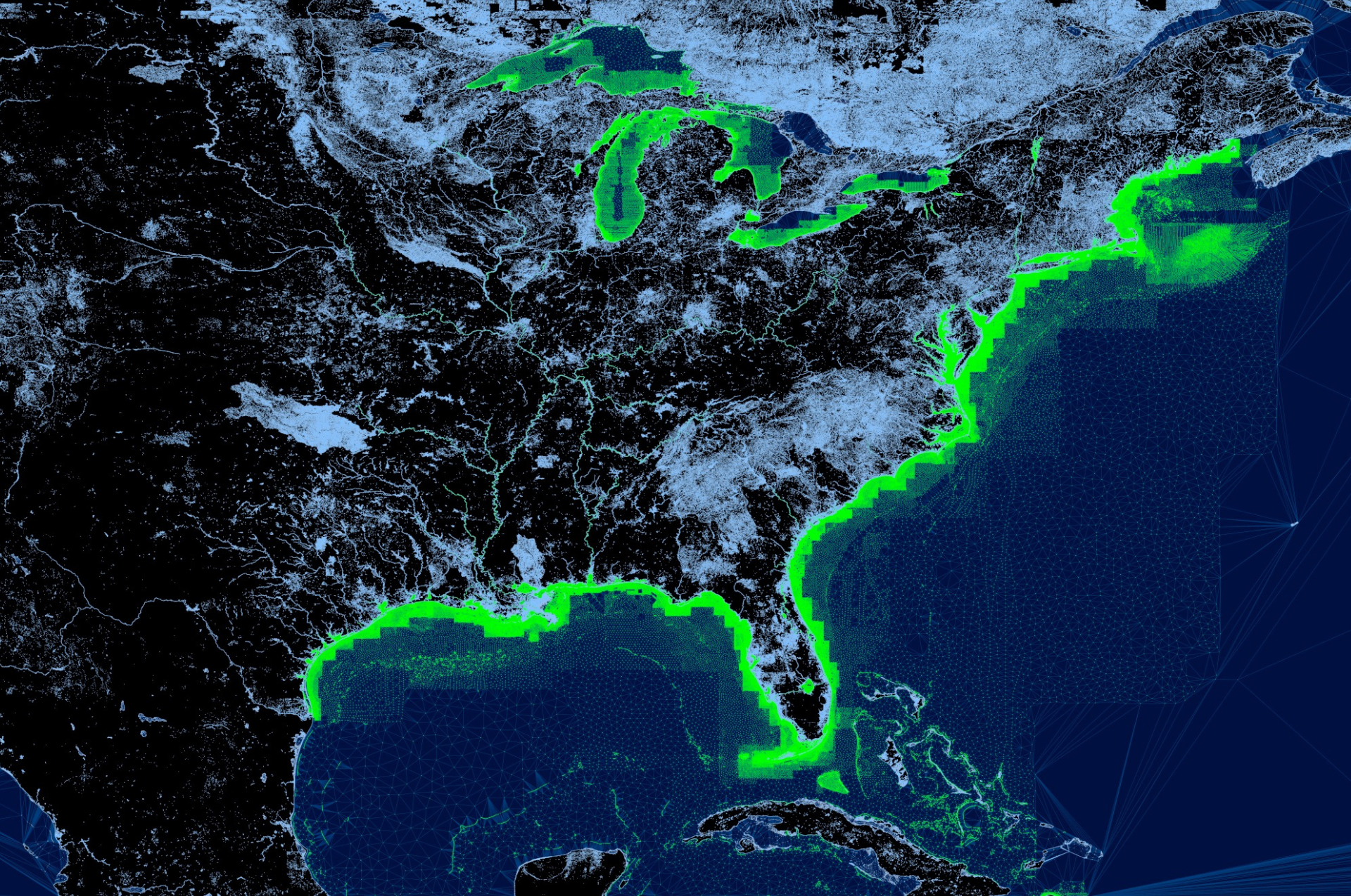
The image above depicts Argo’s extensive water coverage from the coastlines to inland lakes. The green represents current depth coverage and light blue represents waterways without depth numbers (such as some inland lakes).
With our latest release coming next week, our autorouting feature will work on ALL waterways, including inland lakes, but routes will only use depth when available on that body of water.
Our Depth Data
The depth data that we are using is from NOAA and U.S. Army Corp of Engineers (USACE). It is based on low median tide so depth readings should be lower than the actual depth. Also, since NOAA data soundings do not cover all areas some approximations are made particularly closer to shore and around docks.
Canadian Depth
Unfortunately we do not have depth/contour data for Canadian waters yet. We are waiting for permission from the Canadian government for access to their hydrographic data and are also pursuing other possible sources.
We’ll keep you posted as our water coverage continues to expand!


